
The Victoria Waterways Loop
The Galloping Goose trail and the more recent E&N Trail are well known to bicyclists and pedestrians as a way to make a complete circle route from downtown Victoria, out to the 6 Mile Pub area, and back again. However, there is a water route that also allows you to travel a complete circle from the inner harbour and back again.
This route was used for centuries by First Nations People but overtime it fell into disuse. Access to the portage eventually became difficult and it was only known to a few keen local paddlers as a viable paddle route. With recent improvements this route has become viable again, so put on your explorers hat and give this route a try. It will be sure to please.
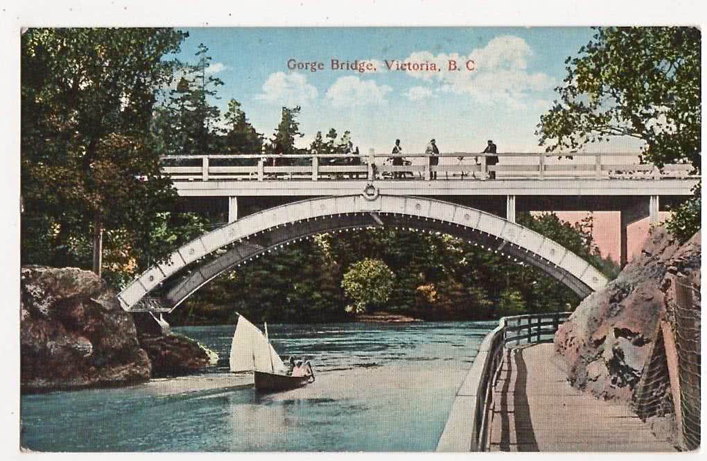
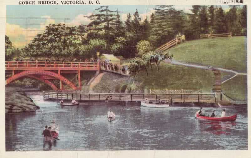
The Tillicum Bridge & Gorge Boardwalk – post card from the early 1900’s
What is the Victoria Waterways Loop?
The Victoria Waterways Loop is a 22 km circle route which allows a paddler to complete a one way trip starting at any number of access points on the Gorge Waterway, Portage Inlet, Victoria Harbour, Esquimalt Lagoon or French Beach. You can start the route by paddling in either direction, complete a short 1 km portage across Portage Park in View Royal and the Old Island Highway, then continue your journey back to the starting point.
What is Happening with the Victoria Waterways Loop?
There have been groups at work to improve this 'marine trail' and access to it. For example, the Victoria Canoe and Kayak Club (VCKC) were influential in advocating for the beautiful Shoreline Portage Trail completed behind Shoreline school in 2015.
View Royal Councillor John Rogers has been a very active promoter of the Victoria Waterways loop. Funding from the Town of View Royal and enable the completion the Portage Trail, constructing the Shoreline access ramp, and providing wayfinding signage between Portage Inlet and Esquimalt Harbour. Another boat ramp has been proposed for the head of Portage Inlet at Linear Park.
Esquimalt Councillor, Ken Armour, has also been active in helping promote the Victoria Waterways Loop and has been promoting a portage around Tillicum Narrows. They are looking at the prospect putting a beach on the southeast side of the bridge and creating a ramp up to the pathway to allow a 0.5 km portage to the beach at Esquimalt Gorge Park.
The City of Victoria has looked into improving beach access at Banfield and Arbutus Parks, as well as an improved 'paddle friendly' dock at Banfield Park.
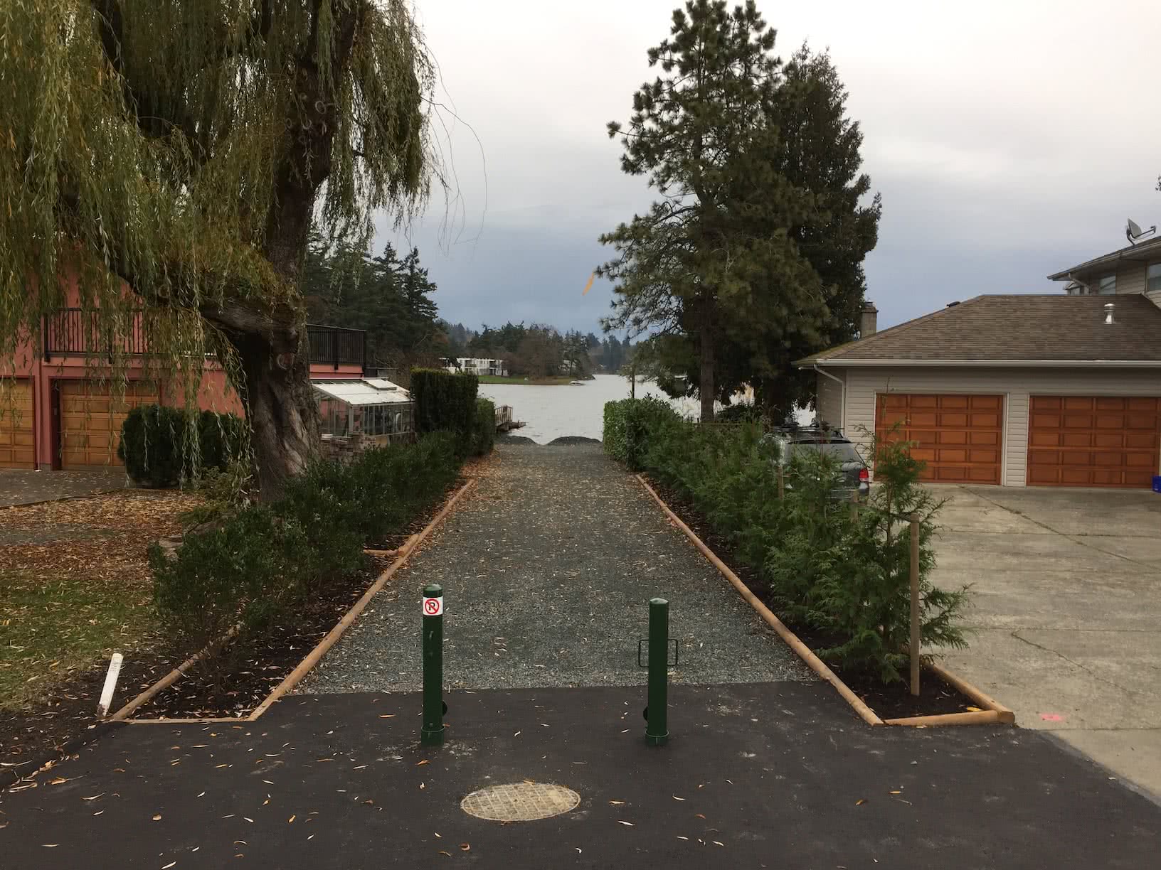
The new Shoreline Ave portage access.
As was mentioned earlier, a major goal of the project is to create a portage underneath the Tillicum bridge. A portage route would allow paddlers of all experience levels to easily and safely bypass the reversing rapids without having to wait on favorable tides. There is existing dock on the north east side of the bridge. But the portage entails ahike up the hill to Tillicum Rd, cross at the traffic light and walk the Gorge Waterway Park path to a launch location beside the Victoria Canoe & Kayak Club.
The idea of a portage at this location is not new, as there was a walkway built in the early 1900’s and remained there in various forms until its removal in 1967 when the existing bridge was built.
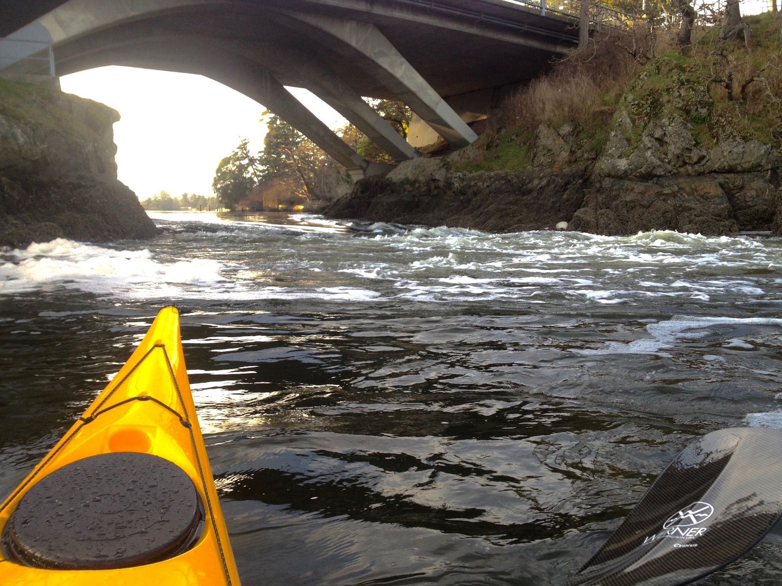
Tillicum Narrows Today
Tillicum Walkway 1900’s
The History
The reversing falls at Tillicum Bridge is historically significant and it used to be much more impressive due to large boulder in the center of the channel, which the Songhees First nations named “Camossung”. Young braves would dive in to the rapids as a cleansing ritual and to obtain special powers.
Later it was a popular swimming and boating location for locals, although there were many drowning incidents because of the rapids. It was also a popular tourist destination with people lining the bridge and walkway to view the rapids. There was even a stern paddle wheeler that brought folks right up to the rapids for a first hand view.
Whether very sad or beneficial, the rapids were changed forever in June 1960 when Robert Southwell, without permission, dynamited the rocks. This permanently tamed the rapids to some degree and has certainly made it safer for boaters attempting to navigate it.
The circle route history persists in more modern times including races sponsored by the VCKC. Here is a fun video of a race from 1986. Click this link: Gorge Circle Route Race 1986
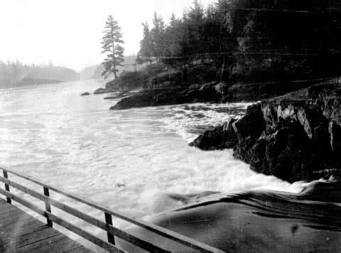
View of ‘Camossung’ from the Walkway- 1900’s
There is an immense amount of history as well as beauty all along this very unique circular marine trail. We are hoping it will become a world class paddling route for locals as well as visitors to our city.

Paddling the Victoria Waterways Loop
If you think you would like to of try The Victoria Waterways Loop and want more information on how to paddle this historic route, check out our blog post by clicking this link: Victoria Circle Paddle Route
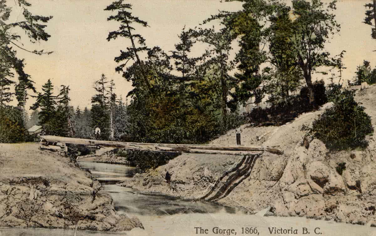
The Gorge Bridge 1866